Delaware, Maryland, Virginia Topographical Wall Map by Raven Maps, 34" x 64"
Raven Maps, Some of the Most Beautiful Maps Available!
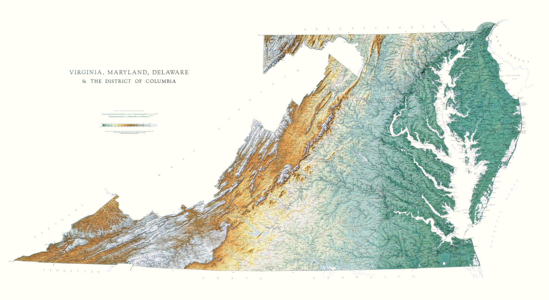
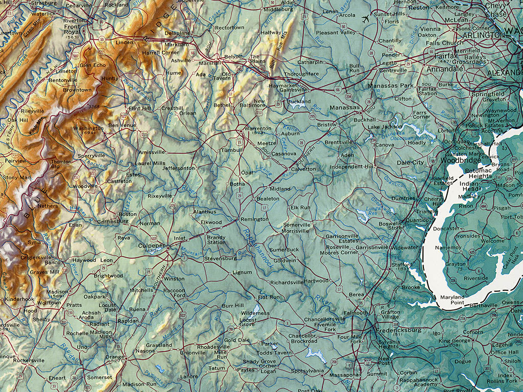
Maps must be accurate, but they should also be beautiful. Raven's state wall maps were prepared using base materials originally produced by the U.S. Geological Survey (USGS) for their definitive 1:250,000-scale topographic map series. These extremely detailed bases identify thousands of features, such as even minor lakes and streams ignored by most maps. Raven Maps brings the USGS materials up to date with current roads and reservoirs. We then go far beyond the originals by adding color tints to depict elevation. The colors progress from greens at lower elevations, through yellows and browns, to grey and finally white at the highest altitudes in the mountainous states. This sequence of color steps replaces the abstraction of contour lines with a graphic picture of elevation and, in combination with the relief shading, of the entire landform.
Our classic map of The Chesapeake Bay area uses elevation tints in subtle hues of green, tan, and brown to show the differences in elevation throughout the states of Maryland, Delaware, and Virginia. This topographic map displays an incredible amount of detail, from cities, highways, and mountain ranges, to valleys, rivers, and small towns. The elevations are represented by color, and this, in combination with our special relief shading technique, gives the map a lush, 3-dimensional look.
Scale: 1:500,000 1"=about 8 miles
This is a 2D flat map
Usually Ships in 24 Hours!