The Martin County, Florida Wall Map by Kappa Map Group measures 73" x 56" (6'1"w x 4'8"h) and offers up-to-date cartography and complete street detail. Its durable surface lamination makes the map markable and washable. Street indexing appears on the face of the map. Framing rails are included on top and bottom for easy wall mounting. Railed wall maps can be turned into pull down maps as a $30 option.
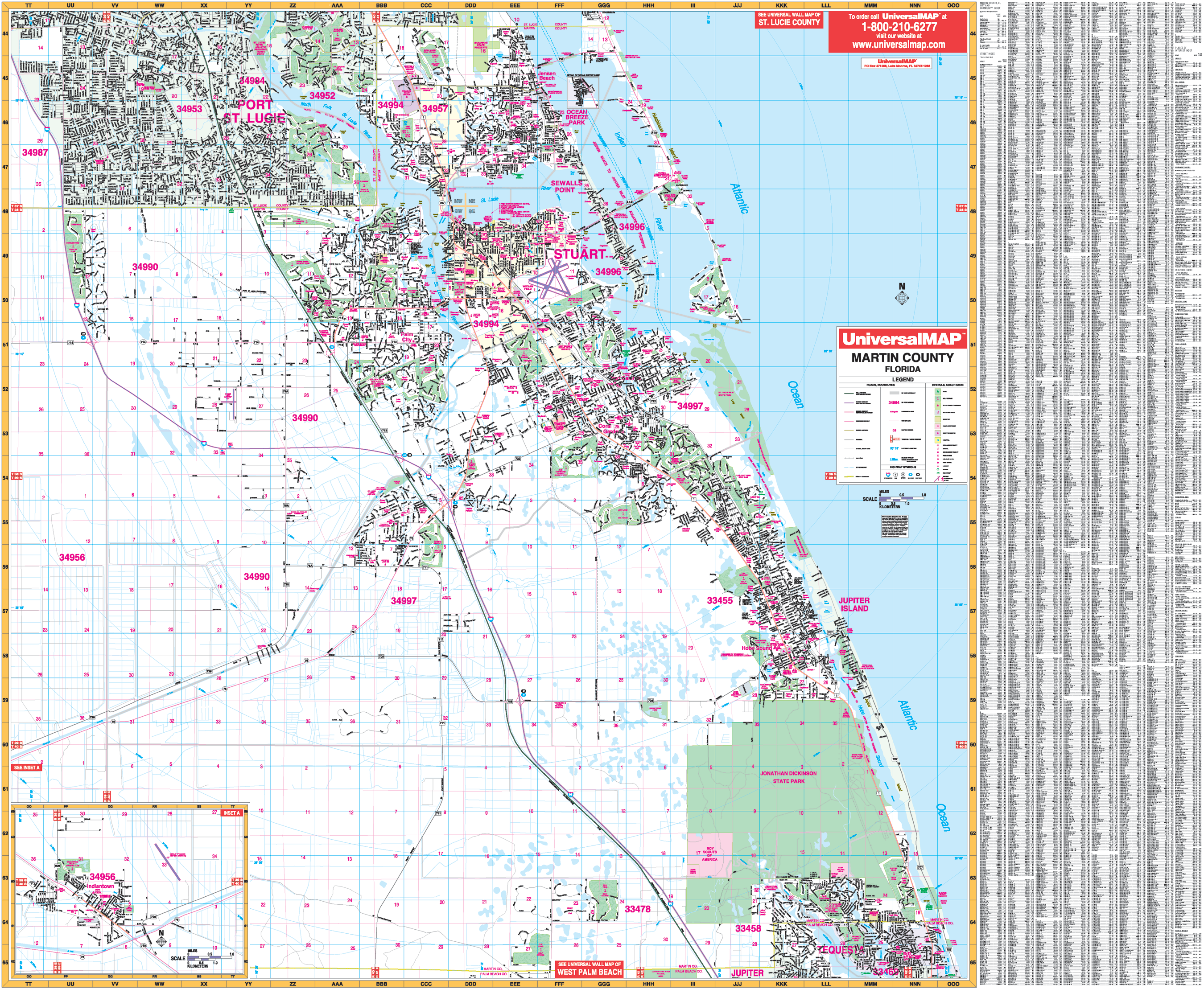
The area of coverage:
?§ North: to the Martin/St. Lucie County line;
?§ South: to the Martin/Palm Beach County line
?§ East: to the Atlantic Ocean;
?§ West: Past Fox Club and the intersection of I ? 95 and SW Martin Hwy (CR -714 )
?§ A map inset covers the community of Indiantown.
Features: all streets and highways, post offices, hospitals, railroads, mileage circles, sections/townships/range lines, city limits/annexations, airports, cemeteries, shopping centers, water features, recreational parks, government buildings, fire and police stations, educational facilities, golf and country clubs, ZIP codes and boundaries, and latitude and longitude lines.
Year: 2013
Edition: 1st
These maps are printed and finished to order. Please allow 4-6 weeks for delivery.