Menu


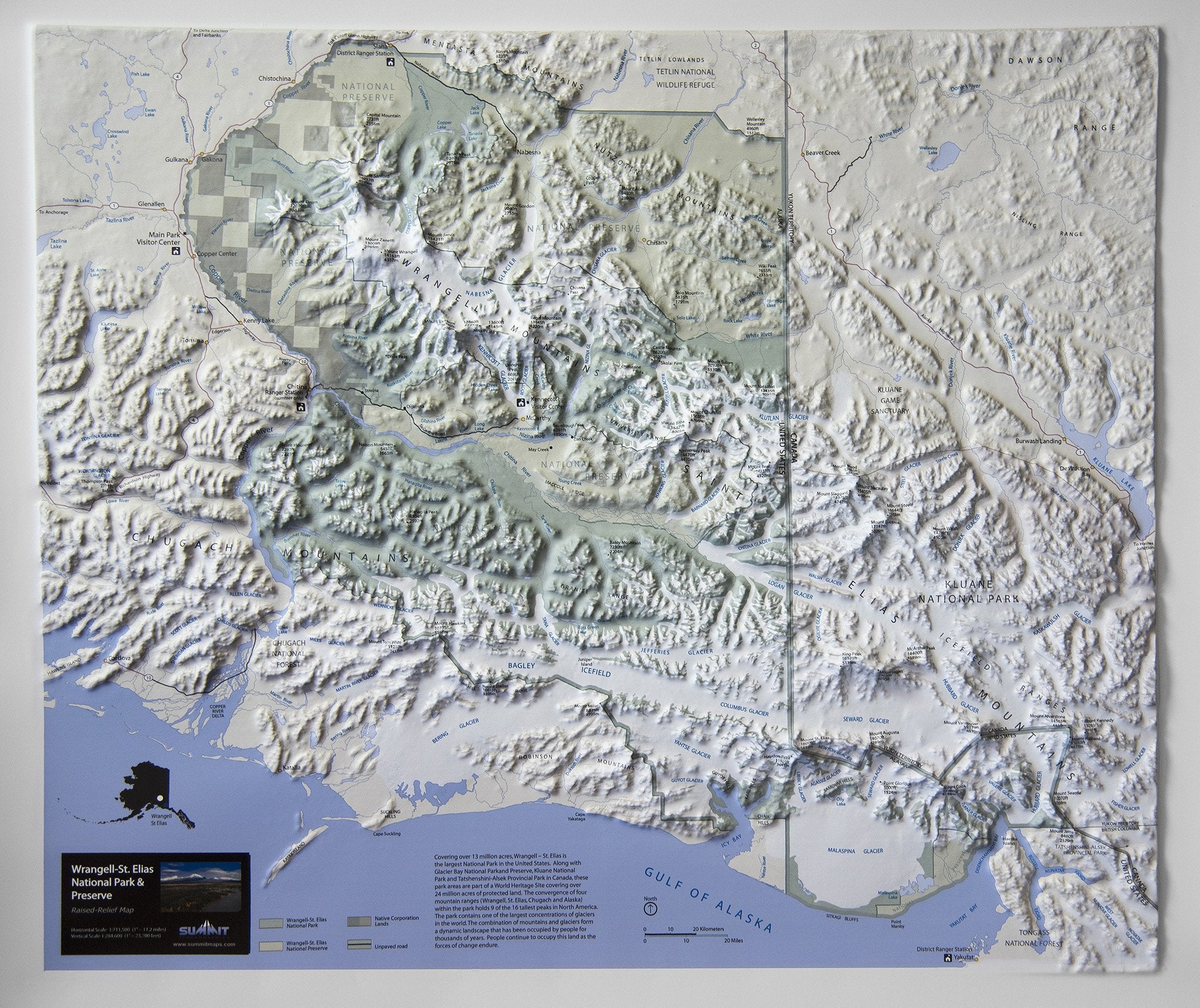
This 3D raised relief map is precisely molded into the true shape of the magnificent Wrangell-St Elias National Park and Preserve. The mountains (9 of the 16 tallest in North America), valleys, glaciers and other geo-features are presented in their true and accurate 3D shape. Visitor centers, ranger stations, roads, towns, mountain peaks, boundaries, rivers, and other points of interest are clearly labeled. The 3D format provides a unique way to understand the park and plan or recall adventures there. It makes a beautiful addition to the wall of any Alaskan wilderness/mountaineering enthusiast’s home, office or classroom. It is available both unframed (poster style) and framed (black aluminum, light or dark stained solid oak wood, or black painted wood).

This large map is available fully framed and ready to hang or unframed, perfect for pinning to a bulletin board.
Usually ships in 5-7 business days. Please allow additional 5 business days for framed options.
This 3D raised relief map is precisely molded into the true shape of the magnificent Wrangell-St Elias National Park and Preserve. The mountains (9 of the 16 tallest in North America), valleys, glaciers and other geo-features are presented in their true and accurate 3D shape. Visitor centers, ranger stations, roads, towns, mountain peaks, boundaries, rivers, and other points of interest are clearly labeled. The 3D format provides a unique way to understand the park and plan or recall adventures there. It makes a beautiful addition to the wall of any Alaskan wilderness/mountaineering enthusiast’s home, office or classroom. It is available both unframed (poster style) and framed (black aluminum, light or dark stained solid oak wood, or black painted wood).
This large map is available fully framed and ready to hang or unframed, perfect for pinning to a bulletin board.
Usually ships in 5-7 business days. Please allow additional 5 business days for framed options.