Menu


Navigating the Great Lakes is an adventure filled with breathtaking views, diverse ecosystems, and rich history. As the largest group of freshwater lakes in the world by total area, the Great Lakes have been a vital part of North America's natural and economic landscape. However, successful navigation on these expansive waters requires more than just a boat and good weather; it necessitates a reliable understanding of the intricacies of the lakes' waters, which is where nautical charts come into play. In this article, we’ll explore the essential nautical charts for navigating the Great Lakes, highlighting their importance, types, key features, and best practices, ensuring that you and your crew can embark on your journey with confidence. Whether you are an avid sailor, a recreational boater, or a fishing enthusiast, learning how to master these charts is fundamental to enhancing your Great Lakes experience.
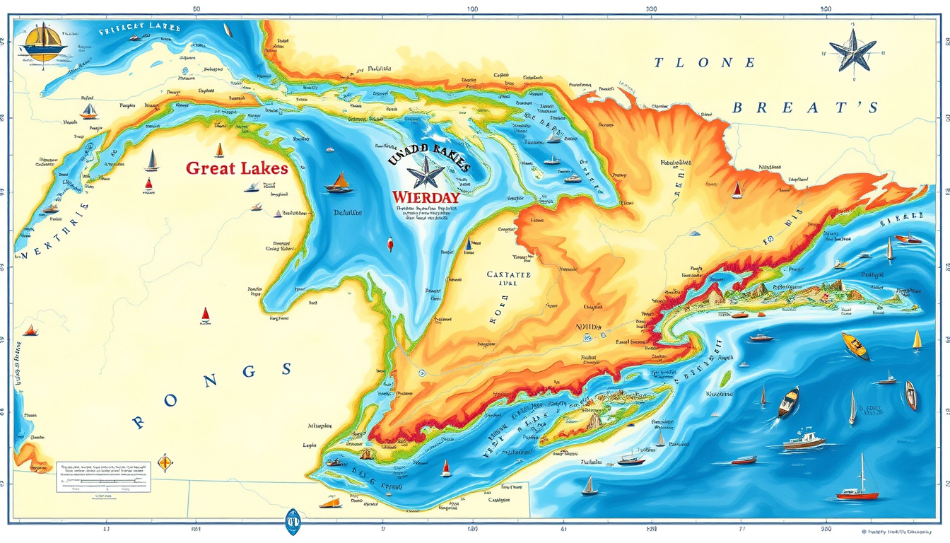
Navigating the Great Lakes: Essential Nautical Charts \nThe Great Lakes region, comprising Lakes Superior, Michigan, Huron, Erie, and Ontario, represents one of North America's most rich and diverse aquatic environments. For sailors, fishermen, and recreational boaters alike, understanding how to safely navigate these expansive waters is crucial. The key to successful navigation lies in using essential nautical charts, which provide a wealth of information about the lakes' depths, hazards, navigational aids, and other critical data that can guide motion upon the water. Whether you're an experienced mariner or new to the sailing world, this post will explore the importance of these nautical charts and highlight why GeoMart is your go-to source for quality maps and chart accessories.
## Importance of Nautical Charts in Navigation Navigating the Great Lakes requires more than just a compass and a boat; it calls for precise and detailed charts. Nautical charts are essential tools for mariners, providing critical information about water depths, hazards, and navigational aids. They are specifically designed to support safe marine navigation, enabling boaters to understand the terrain beneath the water and the positions of buoys, lighthouses, and other markers essential for guidance. Without these charts, navigating the Great Lakes would be akin to exploring a vast uncharted territory, fraught with the risks of running aground or colliding with unseen obstacles. These charts also incorporate detailed topographical information of the lakebed, helping to identify underwater hazards that could jeopardize your journey. With the unique geography of the Great Lakes, which features numerous islands, narrow channels, and shifting depths, having access to quality nautical charts is imperative. For those looking to explore these magnificent bodies of water safely and confidently, GeoMart offers a diverse selection of nautical charts specifically tailored for these regions. By choosing the right nautical chart, boaters can enhance their navigational skills, ensuring a safe and enjoyable adventure on the Great Lakes.
'The sea, once it casts its spell, holds one in its net of wonder forever.' - Jacques Cousteau
Navigating the Great Lakes: Essential Nautical Charts
When it comes to navigating the vast and breathtaking waters of the Great Lakes, having access to accurate and reliable nautical charts is essential for both seasoned mariners and casual boaters alike. The Great Lakes, known for their diverse geography and sometimes unpredictable weather conditions, demand a precise understanding of each waterway to ensure safe and enjoyable travels. In this section, we will explore the various types of nautical charts essential for navigating these magnificent lakes, helping you choose the right tools for your maritime adventures.
###
1. Electronic Nautical Charts (ENCs)
Electronic Nautical Charts (ENCs) are vital tools for modern navigation. These charts are vector-based, allowing mariners to zoom in and out without losing clarity. Typically used in conjunction with nautical charting software or GPS devices, ENCs offer real-time updates and can include a wealth of additional information such as current weather conditions, tidal data, and navigational aids. Ideal for high-tech vessels, these charts provide a comprehensive solution for navigating the Great Lakes.
###
2. Raster Nautical Charts (RNCs)
Raster Nautical Charts (RNCs) are digital versions of traditional paper charts. They are scanned images of existing nautical charts, making them a great option for those familiar with the classic format. RNCs maintain the same critical navigational information as paper charts, including depth soundings, navigational hazards, and key landmarks, but in a convenient digital format. For those who appreciate traditional methods yet want the benefits of technology, RNCs serve as an accessible choice while navigating the Great Lakes.
###
3. Paper Nautical Charts
Don’t underestimate the reliability of traditional paper nautical charts! While technology offers many conveniences, having a physical chart is invaluable for safety and navigation. Paper nautical charts are easy to annotate, durable, and do not rely on power or electronic devices. For first-time navigators or those who prefer the hands-on approach, paper charts can provide a comprehensive overview of the Great Lakes, along with details like shoals, marinas, and points of interest. At GeoMart, you can explore a diverse selection of high-quality paper nautical charts specifically tailored for navigating the Great Lakes.
###
4. Specialized Nautical Charts
In addition to standard nautical charts, specialized charts cater to unique needs. For example, harbor charts provide detailed information about docking facilities and conditions, while fishing charts highlight fishing spots and species habitats within the lakes. Whether you're an avid angler or planning a day of leisure boating, these specialized charts can enhance your experience on the Great Lakes. These purpose-driven charts can be found in GeoMart’s collection, ensuring you have the best equipped resources for your adventures.
When it comes to navigating the Great Lakes, having the right nautical charts is essential for ensuring safety and precision on the water. Here are some key features to look for in these vital navigational tools:
###
1. Scale of the Chart
Choosing a chart with the appropriate scale is crucial. Larger scale charts provide more detail, making them ideal for offshore navigation and intricate areas like marinas and harbors, while smaller scale charts cover broader areas, perfect for route planning.
###
2. Detail and Accuracy
It's important to ensure that the charts are up-to-date and accurate. Nautical charts for the Great Lakes should reflect recent surveys and developments, such as changes in water depth, buoy placements, and any new hazards.
###
3. Depth Contours
Look for charts that include clear depth contours. Understanding water depths is critical for safe navigation, especially in the often shallow areas of the Great Lakes, which can pose risks for larger vessels.
###
4. Topographic Features
In addition to underwater features, good nautical charts should illustrate topographic elements like islands, beaches, and coastlines. Topographic features help in navigating and identifying landmarks, enhancing the overall navigational experience.
###
5. Navigational Aids
Charts should indicate navigational aids such as buoys, lighthouses, and beacons. These aids provide critical information about safe passages and help skippers maintain their bearings.
###
6. Geographical Context
A comprehensive nautical chart will include geographical context, showcasing nearby landforms and relevant maritime boundaries. This feature is invaluable for clear visual navigation, especially for those unfamiliar with the area.
###
7. Regulatory Information
Stay informed about local rules and regulations. Look for charts that provide information about navigational restrictions, such as no-wake zones or seasonal closures, ensuring compliance with local laws while on the water.
###
8. Paper vs. Electronic Charts
Decide between traditional paper nautical charts and electronic versions. Both have their benefits; paper charts are reliable and don’t require power, while electronic charts often come with advanced features like route planning and integration with GPS.
By considering these features while choosing nautical charts for navigating the Great Lakes, you can ensure a safe and enjoyable experience on the water. For a wide array of high-quality nautical charts tailored specifically for Great Lakes navigation, be sure to visit GeoMart.com, your trusted source for all mapping needs!
Navigating the Great Lakes requires careful planning and understanding of the waterway's unique features, and having the right nautical charts is essential to ensure a safe and enjoyable journey. When using nautical charts effectively, consider these essential tips:
###
1. Understand Chart Symbols and Scales
Familiarize yourself with the symbols and notations found on nautical charts. This knowledge is crucial as it helps interpret bathymetric data, navigation aids, and potential hazards. The scale of the chart also matters; larger scales provide a more detailed view of specific areas, while smaller scales cover larger regions.
###
2. Plan Your Route
Before embarking on your voyage, utilize nautical charts to plot your course. Research depth information to avoid shallow areas and identify navigational aids like buoys and lighthouses that will guide your way. In the Great Lakes, where weather and water levels can change rapidly, planning is vital to staying on course.
###
3. Keep Your Charts Updated
Waterways can change due to natural shifts, human activities, or construction projects. Regularly update your nautical charts to ensure you have the latest information. Check for any notices to mariners that may affect your navigation in the Great Lakes region.
###
4. Use Additional Resources
In addition to nautical charts, consider using complementary resources like tide tables, current forecasts, and local nautical guides, which enhance your understanding of local conditions. These resources can provide insights on seasonal changes that may affect navigation.
###
5. Utilize Technology
Incorporate technology by pairing traditional nautical charts with GPS systems and navigation software. While nautical charts are vital for visual guidance, technology can provide real-time positioning and route optimization. However, always cross-check digital resources against physical charts for safety.
###
6. Practice Regularly
As with any skill, navigating effectively with nautical charts requires practice. Regularly using your charts, even in familiar waters, will boost your confidence and ability to read charts accurately. Furthermore, practice makes you adept at quickly assessing real-time situations, which is crucial in unforeseen circumstances.
By leveraging these tips, navigating the Great Lakes can be a much more rewarding endeavor. For those looking to invest in high-quality nautical charts tailored for the Great Lakes, GeoMart offers an extensive selection, ensuring you have access to the right resources for your journey.
Navigating the Great Lakes: Essential Nautical Charts is not just about reaching your destination; it's about enhancing your overall boating experience. The Great Lakes—comprising Lakes Superior, Michigan, Huron, Erie, and Ontario—are vast and beautiful, offering unique challenges and breathtaking views. Using essential nautical charts tailored for these waters can significantly enhance your navigation, ensuring safety and efficiency on your journey. These charts provide detailed topography, water depths, and important navigational markers that are crucial for any boat or ship owner. Beyond safety, they also help you explore the fascinating geography of the lakes, identify popular fishing spots, or discover hidden coves and islands to visit. With the right nautical chart in hand, your adventures across the Great Lakes become more enjoyable and stress-free. At GeoMart, we offer an extensive selection of high-quality nautical charts designed specifically for Great Lakes navigation. By equipping yourself with the best tools available, you can make the most of your time on these magnificent bodies of water, striking the perfect balance between adventure and safety. Explore our offerings today and set sail with confidence!