Menu

Are you ready to embark on an adventure that takes you deep into the heart of nature, where breathtaking landscapes and pristine wilderness await? Exploring national parks is an incredible way to reconnect with nature, and having the right tools, such as topographic maps, can make all the difference. This guide is designed to introduce you to the fascinating world of topographic maps, explaining their importance in outdoor adventures and how they can enhance your experience in our magnificent national parks. In this comprehensive guide, we will discuss what topographic maps are, how to read and understand them, and how to choose the right map for your outdoor escapade. Additionally, we will furnish you with valuable tips for effectively utilizing these maps in the field, ensuring you navigate the stunning terrains of our national parks with confidence. So, gear up and let’s explore the wilderness together!
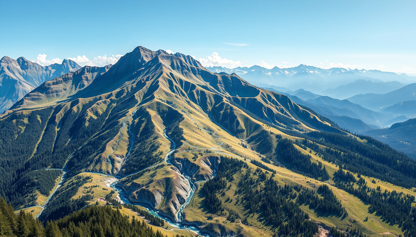
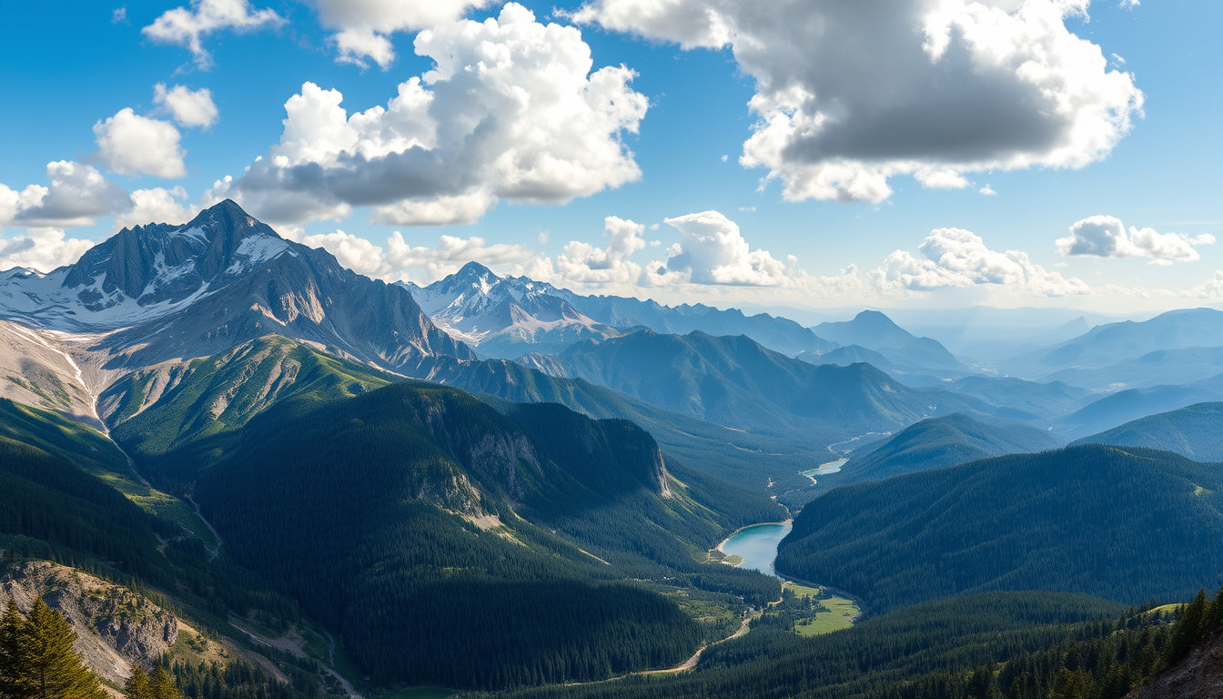
Exploring the great outdoors through our magnificent national parks is one of the most rewarding experiences in nature. These treasured lands, designated for their natural beauty and ecological significance, provide a vital sanctuary for diverse wildlife and a haven for adventure seekers. This blog post will delve into how topographic maps can enhance your experience, making it easier to navigate and appreciate these stunning environments. Whether you’re planning a hiking trip, a camping adventure, or simply looking to gain a better understanding of the geography that shapes our national treasures, understanding the role of topographic maps is crucial. As we explore your national parks, we’ll consider how topographic maps guide us through the undulating landscapes and hidden gems of these breathtaking locations, as well as how you can find high-quality topographic maps at GeoMart, your trusted source for all map-related needs.
What Are Topographic Maps? Topographic maps are detailed representations of the Earth's surface, illustrating the terrain's elevation, slope, and landforms through contour lines, symbols, and colors. They provide vital information about the physical characteristics of a landscape, making them an invaluable resource for various enthusiasts, including hikers, geologists, and outdoor educators. Essentially, a topographic map captures the three-dimensional shape of the land in a two-dimensional format, allowing users to visualize the height and depth of features like mountains, valleys, and rivers. Each contour line on a topographic map connects points of equal elevation—closer lines indicate steeper terrain, while wider spaces suggest gentle slopes. This unique detail aids in planning activities in national parks and outdoor adventures, enabling users to understand challenging terrains, identify trails, and navigate their expeditions effectively. If you want to fully immerse yourself in nature, especially in national parks, exploring with topographic maps is a must. At GeoMart, we offer a variety of high-quality topographic maps to enhance your outdoor experiences and help you navigate nature with confidence.
'The Earth has music for those who listen.' - William Shakespeare
How to Read and Understand Topographic Maps Topographic maps are one of the most essential tools for outdoor enthusiasts, especially those who love to explore national parks. These maps provide a detailed representation of the landscape, showing elevation changes, contours, and various geographical features. Understanding how to read a topographic map is crucial for navigating trails, planning hikes, and appreciating the natural beauty of the terrain. In this section, we'll break down the key elements of topographic maps and how you can use them effectively in your adventures.
1. Contours and Elevation One of the most distinctive features of a topographic map is the use of contour lines. These lines represent elevation, with each line indicating a specific elevation above sea level. Here’s how to decode them:
• Contour Lines: Closer contour lines indicate steep terrain, while wider spaced lines depict flatter areas.
• Index Contours: Every fifth contour line is usually bolded and labeled with its elevation, serving as a reference point for hikers.
• Elevation Gain: By looking at the contour lines, you can quickly assess how much elevation gain lies ahead on your trail, helping you to prepare physically for the hike.
2. Symbols and Legend Topographic maps also feature a variety of symbols, which are explained in the map's legend. Here are some common symbols you should familiarize yourself with:
• Trail Markers: Often indicated by dotted lines, different line styles correspond to the trail type (e.g., hiking, biking).
• Water Bodies: Lakes, rivers, and streams are typically marked in blue, providing crucial information for filtering water or planning breaks.
• Vegetation and Land Use: Green shades indicate forested areas, while areas free of color may indicate open fields or developed land.
3. Scale and Proximity Understanding the scale of your topographic map is essential for navigation. Most topographic maps have a scale (e.g., 1:24,000) that shows how much the terrain has been reduced in size to fit the map. This scale allows you to measure distances accurately:
• Measuring Distance: Use a ruler or a piece of string to measure the distance on the map. Multiply this by the scale to determine actual distance on the ground.
• Planning Routes: Knowing the scale helps you to estimate travel times and understand the time needed to navigate the landscape effectively.
4. Using Topographic Maps for Safety Having a solid understanding of topographic maps can greatly enhance your safety while exploring national parks. Here’s how:
• Route Planning: Before heading out, use the map to identify trails, elevation changes, and possible hazards like steep cliffs or rocky terrain.
• Emergency Navigation: In case you lose your way, a topographic map can lead you back to familiar landmarks or safe areas.
5. Practical Applications of Topographic Maps Topographic maps are not just for hikers; they are valuable for a range of activities in national parks, including:
• Camping: Finding the perfect camping spot involves understanding elevation and proximity to water sources, both of which are detailed on topographic maps.
• Photography: Knowing the terrain helps photographers plan shoots at the right time of day for optimal lighting on landscapes.
• Wildlife Observation: Understanding the terrain can lead to good wildlife spotting locations, especially in varied landscapes featuring multiple habitats. Conclusion Understanding how to read topographic maps opens up a world of adventure in national parks, guiding outdoor enthusiasts through challenging terrains and enhancing their experience in nature. Whether you're preparing for a serious hike or a leisurely outing, knowing how to interpret these maps is invaluable. At GeoMart, we provide a wide variety of topographic maps and guides tailored to exploring national parks. Visit GeoMart.com to explore your options and get ready for your next adventure!
Choosing the Right Topographic Map for Your Adventure When it comes to exploring your national parks, one of the most essential tools you can carry is a topographic map. Unlike standard road maps, topographic maps provide detailed representations of the terrain, showing elevation changes, landforms, and even the contours that define the landscape. Whether you’re an avid hiker, a thoughtful backpacker, or just someone looking to enjoy the outdoors more fully, understanding how to choose the right topographic map is crucial for a successful adventure. Understanding Topographic Maps Topographic maps are designed to illustrate the three-dimensional terrain on a two-dimensional plane, using contour lines to indicate elevation. Each line represents a specific elevation point: the closer the lines are to each other, the steeper the terrain. This information is invaluable for navigating through national parks, particularly those with rugged landscapes. Types of Topographic Maps
1. Standard Topographic Maps: These are the classic maps you’ll often find for national parks. They detail all topographical features, including peaks, valleys, and bodies of water, alongside trails and roads. Perfect for hiking, these maps help you to gauge your physical exertion against the elevation changes within the park.
2. Specialty Themed Maps: Some topographic maps focus on specific activities such as mountain biking, bird watching, or climbing. These maps often highlight trails best suited for the selected activity, which can enhance your experience by guiding you to the lesser-known paths.
3. Digital Topographic Maps: Technology lets you take your topographic maps to another level. With apps and GPS devices, you can now download maps for offline use, allowing you to navigate with precision even when you lose cell service in remote areas. Understandably, this feature is essential for safety and exploring the vast expanses of the national parks. Features to Look For in Topographic Maps When selecting a topographic map for your national park adventure, consider the following features:
• Scale: A map’s scale determines how much detail is included. A smaller scale (e.g., 1:100,000) covers a larger area, while a larger scale (e.g., 1:24,000) provides greater detail. Choose the one that fits your needs based on how much hiking or exploring you plan to do.
• Legend: Familiarize yourself with the map's legend to understand the symbols used for trails, natural features, and campgrounds. This in-depth knowledge will boost your confidence as you navigate.
• Updates: Ensure the map is up to date. Trails and elevations can change due to natural occurrences; an outdated map might lead you astray. Practical Uses for Topographic Maps Topographic maps can serve multiple purposes beyond just navigation. Here are some practical uses:
• Planning Your Route: Use your map to identify potential camping areas, landmarks, and the most scenic trails. This can transform a basic adventure into an unforgettable experience, filled with breathtaking views.
• Tracking Your Progress: As you hike, the ability to see your elevation and distance traveled can help you gauge how much further you need to go, allowing you to pace yourself appropriately.
• Understanding Wildlife Habitats: Knowledge of topography reveals vital information about various habitats within the park, making it easier to observe wildlife in their natural settings. Why Choose GeoMart for Your Topographic Maps? At GeoMart, you can find a diverse range of topographic maps designed specifically for exploring national parks. With our extensive selection and expertise, you can trust that you’re acquiring high-quality maps that enhance your outdoor experiences. Not only that, but our products come with a satisfaction guarantee, giving you peace of mind as you venture into the great outdoors. Conclusion Choosing the right topographic map can elevate your national park exploration from ordinary to extraordinary. With the detailed terrain information and various types available, you can navigate confidently and truly immerse yourself in the beauty of nature. At GeoMart, we’re here to supply you with high-quality maps tailored to your adventurous needs, ensuring every trip into the wild is memorable. So why wait? Explore your national parks with the right topographic maps and visit GeoMart.com to get started on your journey!
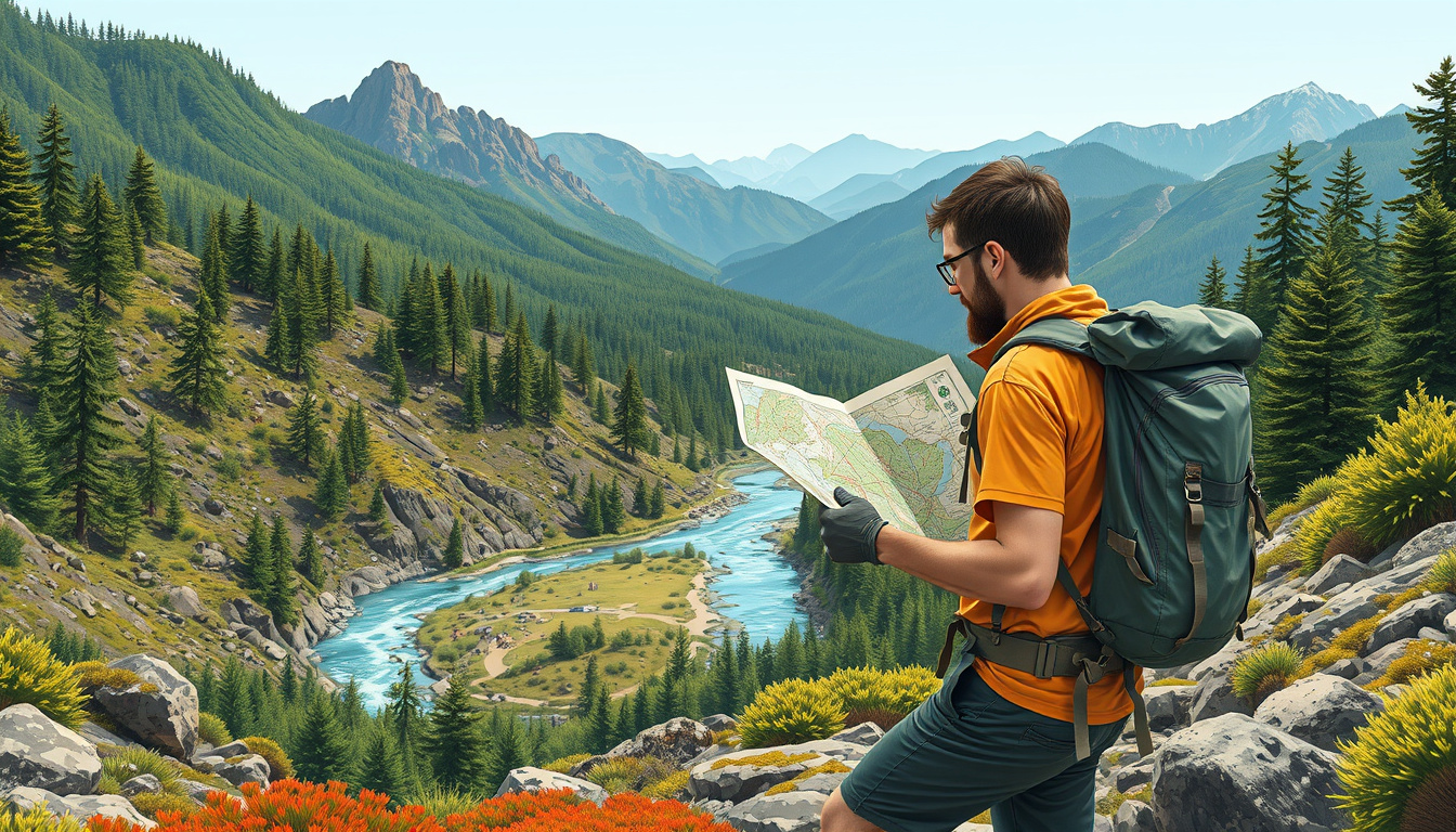
Tips for Using Topographic Maps in the Field When venturing into the breathtaking landscapes of national parks, having a topographic map in hand can be an invaluable asset. These maps provide detailed information about the terrain, including elevation changes, vegetation patterns, and natural features, which can greatly enhance your hiking or camping experience. Here are some practical tips for using topographic maps effectively in the field to ensure a memorable adventure:
1. Familiarize Yourself Before You Go: Spend some time before your trip studying your topographic map. Understand the symbols, contour lines, and scale. Identify key landmarks, trails, and any potential hazards. Having a clear image of the area will boost your confidence when navigating.
2. Use a Compass Alongside Your Map: While a topographic map is essential, pairing it with a compass will improve your navigation. Learn how to read both and practice triangulation technique to gauge your exact location. Align the directional arrow of your compass with the north on your map for accurate bearings.
3. Plan Your Route: Topographic maps are great for route planning; outline your intended path, taking into account elevation changes and potential challenges such as steep or rugged terrain. Consider shorter segments over difficult areas to avoid fatigue. Always have a backup route in case of unexpected conditions or closures in the park.
4. Track Elevation Changes: Pay attention to the contour lines on your topographic map. Each contour line represents a particular elevation, and the distance between lines indicates the steepness of the terrain. Steeper climbs will have closely spaced lines, while flatter areas will have more spaced-out lines. Keep this in mind to prepare for any physical exertion required on your hike.
5. Look for Natural Features: Topographic maps highlight numerous natural features, such as rivers, lakes, mountain peaks, and valleys. Use these features as reference points to stay oriented. Knowing that a river should be nearby can reassure you that you’re on the right path.
6. Stay Aware of Your Surroundings: Checking your map regularly while keeping an eye on your surroundings is crucial. Look for markers or features on the landscape that match your map. This helps in confirming your position during your hike and keeps you attuned to the environment.
7. Practice Navigation Skills: If you’re new to navigating with topographic maps, practice in familiar areas before heading to the park. Familiarity with navigating can make a huge difference when you find yourself amidst the beauty of nature. By following these tips and using topographic maps effectively, you can enhance your exploration of national parks, immersing yourself in the unique natural beauty and challenges they offer. For those ready to begin their adventure, check out GeoMart's extensive collection of topographic maps and accessories designed specifically for adventurers and nature enthusiasts like you!
In summary, topographic maps serve as essential tools for anyone eager to explore the stunning landscapes of our National Parks. By providing detailed information about terrain, elevation changes, and natural features, these maps empower adventurers to plan their routes effectively, ensuring a safe and enjoyable experience in the great outdoors. With the rise of hiking and nature exploration, having a topographic map on hand is more critical than ever. At GeoMart, we understand the passion for exploring these majestic environments; that’s why we offer a diverse selection of topographic maps tailored for each National Park, complete with accurate details and rich features. Our commitment to quality and variety means you’ll find exactly what you need to enhance your adventure. So, whether you’re scaling the heights of the Rockies or wandering through the lush trails of the Smokies, consider visiting GeoMart.com to explore our extensive range of topographic maps and gear that will guide you through your next National Park adventure.