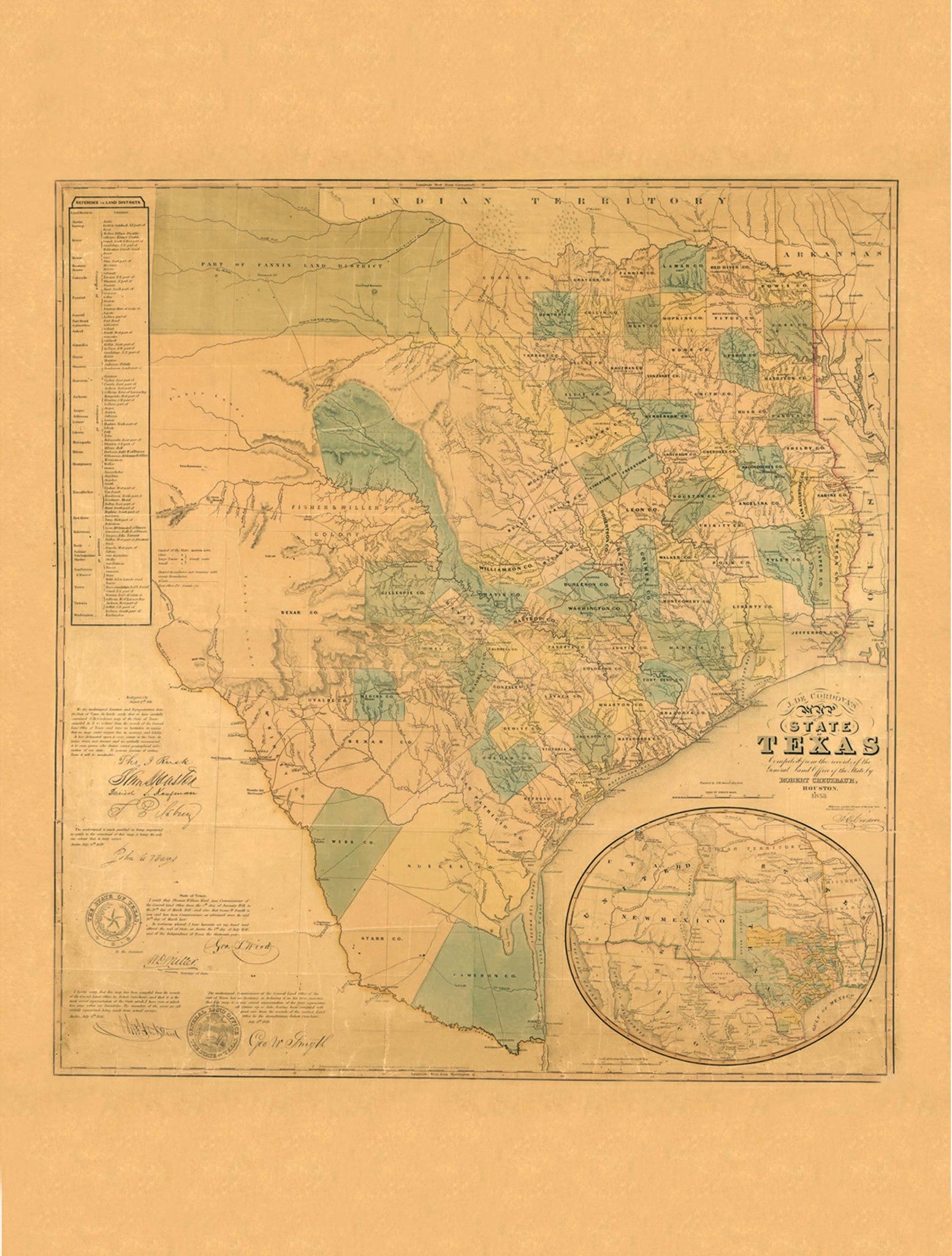
The Texas 1853 Historical Print Mounted Wall Map is J. De Cordova"s Map of the State of Texas, circa 1853. Retrieved from the Library of Congress, Geography and Map Division, and digitally restored by Kappa Map Group in 2011.
This beautifully-detailed illustration shows the state as it was in that time period, including counties, shaded relief and an inset map showing New Mexico reaching to the Pacific Ocean. The map also includes the State of Texas Seal, the Land Office Seal and several signatures of Senators and Representatives from Texas, during that time period. Vintage coloring and some untouched imperfections give this modern print a historic feel. This map is laminated, mounted on foamcore and ready to frame. A beautiful addition to any home or office!
48" x 36"
Map is available with the following options:
- Foam Board: Map is laminated and mounted on foam board.
- Silver/Black Framed: Map is laminated and mounted on foam board with your choice of a silver or black metal frame.
These maps are printed and finished to order. Please allow 4-6 weeks for delivery.