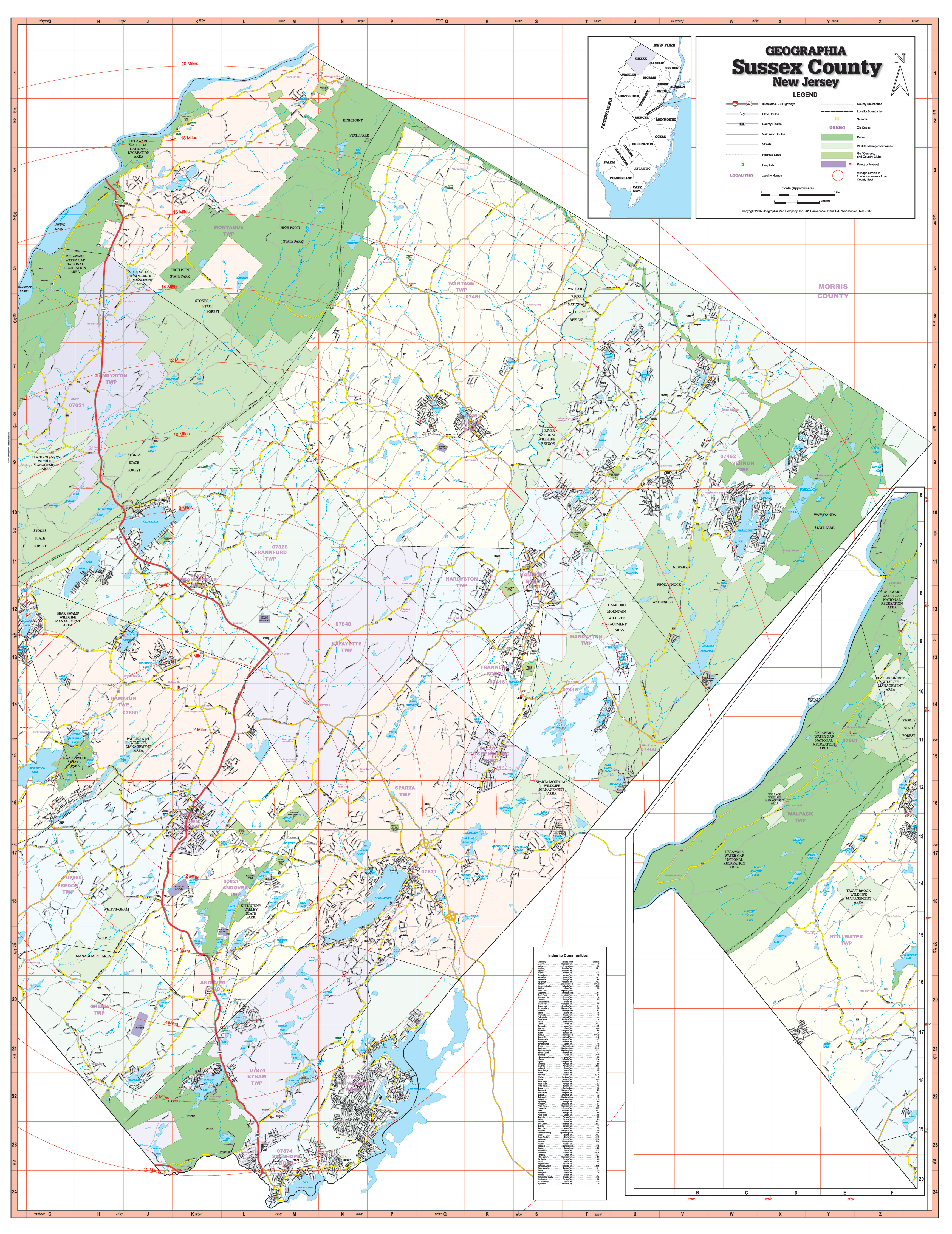
Sussex County, New Jersey is a 1st edition Wall Map published by Geographia Maps. Measures 54? W x 70? H in complete street detail at a scale of 1? = 2,677 feet. Printed in color with a markable/washable-laminated surface. Includes separate book indexing. Provided with hanging rails mounted top and bottom.
Area of coverage: All of Sussex County, with the following boundaries: North: Orange/Sussex County line; South: Morris-Sussex County line; East: Morris-Passaic-Sussex County line; West: Penn State and Warren-Sussex County line.
Details included: airports, cemeteries, hospitals, railroads, post offices, ZIP codes, streets/highways, shopping centers, recreational parks, mileage circles, shopping centers, government buildings, fire/police stations, educational facilities, golf/country clubs, city limits/annexations, and points of interest.
Railed wall maps can be turned into pull down maps on spring rollers for an additional $30.
Year: 2005
Edition: 1st
These maps are printed and finished to order. Please allow 4-6 weeks for delivery.