Queens, NY Wall Map Available from UniversalMAP
UniversalMAP is proud to announce publication of our wall map of Queens, NY by Hagstrom.
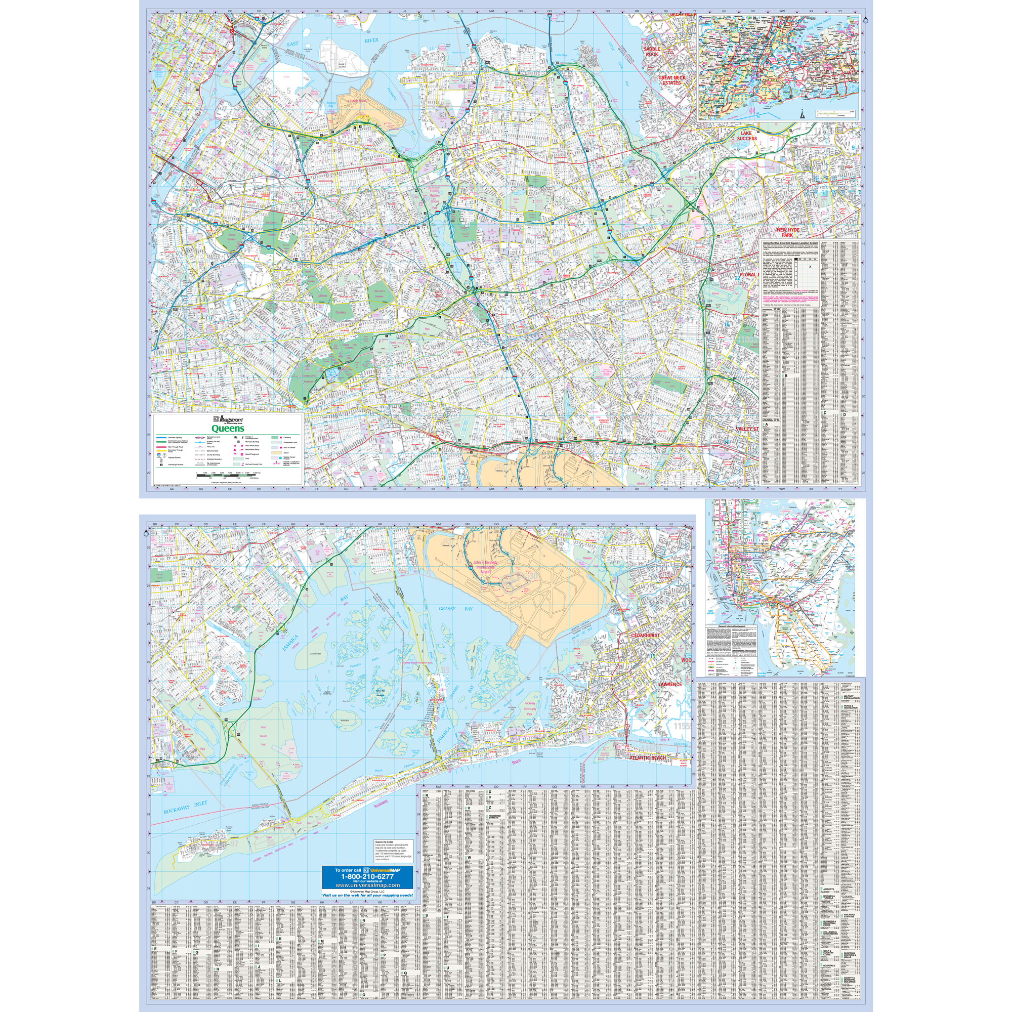
Specifications of this high quality map include: Measures 4'3" W x 6' H (51? x 72?)
Up-to-date cartography at a scale of 1" = 1,724 feet. Printed in color with a markable and washable laminated surface. Hanging options of spring roller; or rails, mounted top and bottom. Streets are indexed on the face of the map, plus index book form.
Areas of Coverage: The New York City borough of Queens. Coverage includes North: to East River; South: to Rockaway Beach; East: portions of Nassau County, New Hyde park, Valley Stream Cedarhurst; West: New York County Line. Area map of Tri-State Area.
NYC Subway Transit System Inset. Details include: All streets, State County Highways, Interstate Highways, Subway Railroad lines, Cemeteries, Neighborhood Names, Schools, Golf Courses Country clubs, Points of Interest, Post Offices, Points of Interest, Hospitals, ZIP Codes Boundaries, Block Numbers, Parks, Longitude Latitude, Airports.
Year: 2011
Edition: 1st
These maps are printed and finished to order. Please allow 4-6 weeks for delivery.