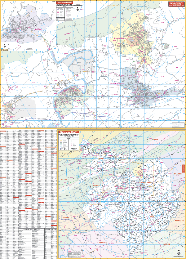
The Blacksburg, Virginia Wall Map by Kappa Map Group includes Christiansburg, Radford, and Pulaski with surrounding areas. Measures 50 by 72 inches (4' 2" W x 6' H). Provides up-to-date cartography in complete street detail with new streets/changes at a scale of 1" = 2,346 feet. Printed in color, laminated, and indexed on the face of the map.
Coverage is in two sections. Section I ranges: North: to Jefferson National Forest, Brush Mountain Estates; South: to Interstate Highway 81; East: to include Christiansburg; West: to Dublin. Also includes an inset of Pulaski.
Section II offers a 4-county inset of Montgomery, Floyd, Pulaski, and Giles.
Details all streets/highways, government buildings, ZIP codes/boundaries, airports, golf courses/country clubs, railroads, city limits and annexations, post offices, shopping centers, cemeteries, educational facilities, fire/police stations, hospitals, recreational parks, water features, mileage circles, and points of interest.
Framing rails are included on top and bottom for easy wall mounting. Railed wall maps can be turned into pull down maps on spring rollers for an additional $30.
Year: 2008
Edition: 2nd
These maps are printed and finished to order. Please allow 4-6 weeks for delivery.